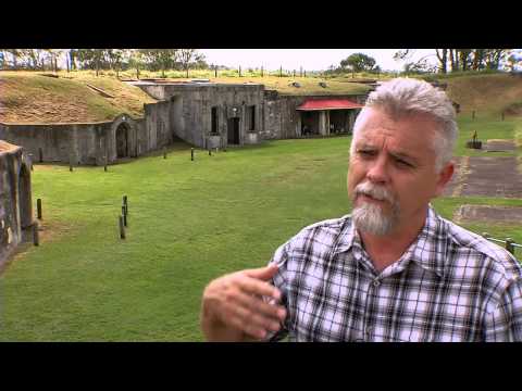
A new handheld 3D mobile mapping system called ‘Zebedee’ has been developed by Australia‘s national science agency, CSIRO (the Commonwealth Scientific and Industrial Research Organisation). It uses a primary sensor (a 2D Hokuyo lidar scanner) on a simple spring mechanism (hence the name Zebedee from The Magic Roundabout) which measures the distances to surfaces in the environment and that can gather an impressive 43,200 samples per second. From this, they can develop a 3D field of view, interpreting the raw data to estimate the motion of the scanner and generate a 3D point cloud model of the environment.
The system is capable of large-scale mapping of a wide variety of environments ranging from built to natural scenes. Typically, the time it takes to map an environment is the time it takes to walk through it.
As you can see from the video, the technology can be used to give people an architectural experience of places that they might not normally be able to go. For instance, the BBC recently ran a feature about the device showing the Tower of Pisa interior mapped in 3D; once the map was created and the data was is at your fingertips, you can experience the tower from vantage points you couldn’t otherwise access, as the BBC video demonstrates.
This information can be extended further and you can overlay historic data with data collected today to get an idea of what changes have happened over time. This is of course critical in helping us to understand how we can preserve our cultural heritage for future generations.
Paul Johnson is Editor of A Luxury Travel Blog and has worked in the travel industry for more than 30 years. He is Winner of the Innovations in Travel ‘Best Travel Influencer’ Award from WIRED magazine. In addition to other awards, the blog has also been voted “one of the world’s best travel blogs” and “best for luxury” by The Daily Telegraph.
Did you enjoy this article?
Receive similar content direct to your inbox.
Subscribe!
Subscribe today to get our weekly newsletter! You don’t want to miss out!
 As you can see from the video, the technology can be used to give people an architectural experience of places that they might not normally be able to go. For instance, the BBC recently ran a feature about the device showing the Tower of Pisa interior mapped in 3D; once the map was created and the data was is at your fingertips, you can experience the tower from vantage points you couldn’t otherwise access, as the BBC video demonstrates.
This information can be extended further and you can overlay historic data with data collected today to get an idea of what changes have happened over time. This is of course critical in helping us to understand how we can preserve our cultural heritage for future generations.
As you can see from the video, the technology can be used to give people an architectural experience of places that they might not normally be able to go. For instance, the BBC recently ran a feature about the device showing the Tower of Pisa interior mapped in 3D; once the map was created and the data was is at your fingertips, you can experience the tower from vantage points you couldn’t otherwise access, as the BBC video demonstrates.
This information can be extended further and you can overlay historic data with data collected today to get an idea of what changes have happened over time. This is of course critical in helping us to understand how we can preserve our cultural heritage for future generations.